 vesseltracker.com
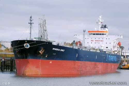
Vessel Minerva Emily IMO: 9380063, MMSI: 229084000 Crude Oil Tanker
UTC, 9.52227, -13.71217, course: 49, speed: 0
UTC, 9.52218, -13.71190, course: 49, speed: 0
2026-02-12 23:26:24 UTC, 9.52227, -13.71217, course: 49, speed: 0
Live AIS position:
UTC. Near Conakry),
updated 2026-02-12 23:26:24 UTC.
Find the position of the vessel Minerva Emily on the map. The latter are known coordinates and path.
marine traffic ship tracker show on live map
The current position of vessel Minerva Emily is 9.52227 lat / -13.71217 lng. Updated: 2026-02-12 23:26:24 UTCDetails:
Last coordinates of the vessel:
UTC, 9.52212, -13.71237, course: 49, speed: 0UTC, 9.52227, -13.71217, course: 49, speed: 0
UTC, 9.52218, -13.71190, course: 49, speed: 0
2026-02-12 23:26:24 UTC, 9.52227, -13.71217, course: 49, speed: 0