 vesseltracker.com
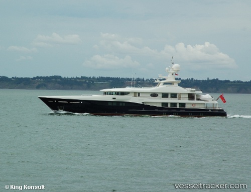
Vessel Deniki IMO: 1009077, MMSI: 229852000 Service Ship
UTC, 43.16908, 5.61414, course: 220, speed: 0
UTC, 43.16909, 5.61414, course: -1, speed: 0
2026-02-24 11:41:12 UTC, 43.16909, 5.61416, course: -1, speed: 0
Live AIS position:
UTC. Near LA CIOTAT),
updated 2026-02-24 11:41:12 UTC.
Find the position of the vessel Deniki on the map. The latter are known coordinates and path.
marine traffic ship tracker show on live map
The current position of vessel Deniki is 43.16909 lat / 5.61416 lng. Updated: 2026-02-24 11:41:12 UTCCurrently sailing under the flag of Malta
Deniki built in 2007 year
Details:
Last coordinates of the vessel:
UTC, 43.16909, 5.61412, course: 220, speed: 0UTC, 43.16908, 5.61414, course: 220, speed: 0
UTC, 43.16909, 5.61414, course: -1, speed: 0
2026-02-24 11:41:12 UTC, 43.16909, 5.61416, course: -1, speed: 0