 vesseltracker.com
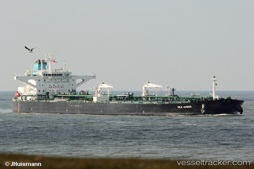
Vessel Sea Amber IMO: 9772931, MMSI: 241466000 Crude Oil Tanker
UTC, 44.26074, 37.84515, course: 248, speed: 7.7
UTC, 44.45271, 37.61033, course: 134, speed: 6.2
2026-01-30 07:57:49 UTC, 44.45374, 37.61591, course: 130, speed: 2.5
Live AIS position:
UTC. 13 nm S of Cpc Terminal),
updated 2026-01-30 07:57:49 UTC.
Find the position of the vessel Sea Amber on the map. The latter are known coordinates and path.
marine traffic ship tracker show on live map
The current position of vessel Sea Amber is 44.45374 lat / 37.61591 lng. Updated: 2026-01-30 07:57:49 UTCCurrently sailing under the flag of Greece
Details:
Last coordinates of the vessel:
UTC, 44.62203, 37.83186, course: 236, speed: 9.1UTC, 44.26074, 37.84515, course: 248, speed: 7.7
UTC, 44.45271, 37.61033, course: 134, speed: 6.2
2026-01-30 07:57:49 UTC, 44.45374, 37.61591, course: 130, speed: 2.5