 vesseltracker.com
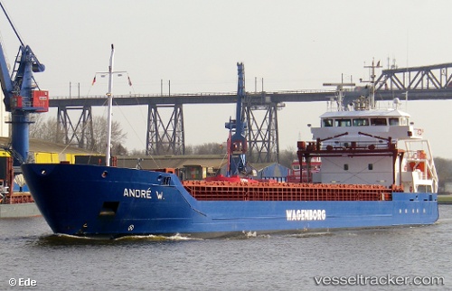
Vessel GEULBORG IMO: 9518232, MMSI: 245943000 General Cargo Ship
UTC, 61.12651, 21.43591, course: 262, speed: 0
UTC, 61.12650, 21.43591, course: 263, speed: 0
2026-02-24 02:16:18 UTC, 61.12652, 21.43589, course: 263, speed: 0
Live AIS position:
UTC. Near Rauma),
updated 2026-02-24 02:16:18 UTC.
Find the position of the vessel GEULBORG on the map. The latter are known coordinates and path.
marine traffic ship tracker show on live map
The current position of vessel GEULBORG is 61.12652 lat / 21.43589 lng. Updated: 2026-02-24 02:16:18 UTCCurrently sailing under the flag of Netherlands
GEULBORG built in 2010 year
Deadweight:
5279 tDetails:
Last coordinates of the vessel:
UTC, 61.12651, 21.43592, course: 263, speed: 0UTC, 61.12651, 21.43591, course: 262, speed: 0
UTC, 61.12650, 21.43591, course: 263, speed: 0
2026-02-24 02:16:18 UTC, 61.12652, 21.43589, course: 263, speed: 0