 vesseltracker.com
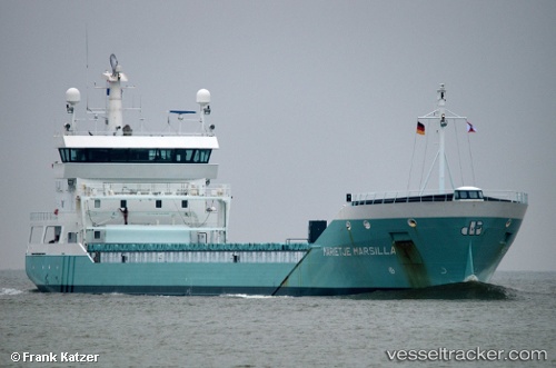
Vessel Marietje Marsilla IMO: 9458248, MMSI: 246754000 General Cargo Ship
UTC, 53.96608, 8.58147, course: 281, speed: 15.8
UTC, 54.02098, 7.90869, course: 274, speed: 12.9
2026-02-03 21:49:32 UTC, 53.97906, 7.33948, course: 255, speed: 12.7
Live AIS position:
UTC. 15 nm N of Baltrum),
updated 2026-02-03 21:49:32 UTC.
Find the position of the vessel Marietje Marsilla on the map. The latter are known coordinates and path.
marine traffic ship tracker show on live map
The current position of vessel Marietje Marsilla is 53.97906 lat / 7.33948 lng. Updated: 2026-02-03 21:49:32 UTCCurrently sailing under the flag of Netherlands
Marietje Marsilla built in 2010 year
Deadweight:
8334 tDetails:
Last coordinates of the vessel:
UTC, 53.89362, 9.14443, course: 227, speed: 0UTC, 53.96608, 8.58147, course: 281, speed: 15.8
UTC, 54.02098, 7.90869, course: 274, speed: 12.9
2026-02-03 21:49:32 UTC, 53.97906, 7.33948, course: 255, speed: 12.7