 vesseltracker.com
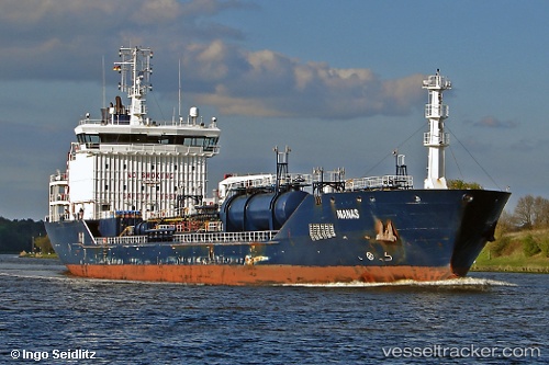
Vessel Manas IMO: 9447055, MMSI: 249498000 Chemical Oil Products Tanker
UTC, 37.60541, -69.13181, course: 277, speed: 5.9
UTC, 37.63026, -69.31641, course: 281, speed: 4.7
2026-02-08 16:12:04 UTC, 37.19510, -69.32762, course: 182, speed: 12
Live AIS position:
UTC. 220 nm SE of Offshore Ambrose),
updated 2026-02-08 16:12:04 UTC.
Find the position of the vessel Manas on the map. The latter are known coordinates and path.
marine traffic ship tracker show on live map
The current position of vessel Manas is 37.19510 lat / -69.32762 lng. Updated: 2026-02-08 16:12:04 UTCCurrently sailing under the flag of Malta
Manas built in 2008 year
Deadweight:
10744 tDetails:
Last coordinates of the vessel:
UTC, 37.57867, -68.86467, course: 281, speed: 6UTC, 37.60541, -69.13181, course: 277, speed: 5.9
UTC, 37.63026, -69.31641, course: 281, speed: 4.7
2026-02-08 16:12:04 UTC, 37.19510, -69.32762, course: 182, speed: 12