 vesseltracker.com
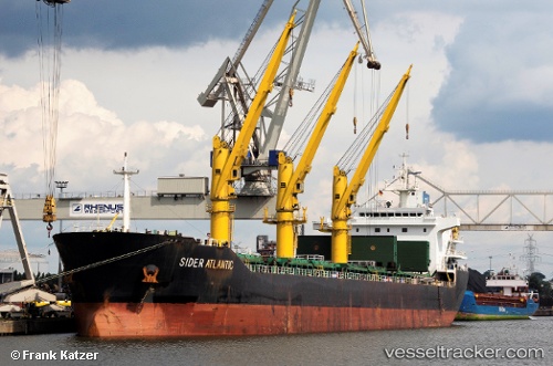
Vessel SIDER ATLANTIC IMO: 9618795, MMSI: 255702000 General Cargo Ship
UTC, 53.74245, -0.26356, course: -1, speed: 0
UTC, 53.74245, -0.26358, course: 107, speed: 0
2026-02-26 21:53:04 UTC, 53.74245, -0.26358, course: -1, speed: 0
Live AIS position:
UTC. Near Marfleet),
updated 2026-02-26 21:53:04 UTC.
Find the position of the vessel SIDER ATLANTIC on the map. The latter are known coordinates and path.
marine traffic ship tracker show on live map
The current position of vessel SIDER ATLANTIC is 53.74245 lat / -0.26358 lng. Updated: 2026-02-26 21:53:04 UTCCurrently sailing under the flag of Portugal (MAR)
SIDER ATLANTIC built in 2011 year
Deadweight:
25469 tDetails:
Last coordinates of the vessel:
UTC, 53.74245, -0.26353, course: 107, speed: 0UTC, 53.74245, -0.26356, course: -1, speed: 0
UTC, 53.74245, -0.26358, course: 107, speed: 0
2026-02-26 21:53:04 UTC, 53.74245, -0.26358, course: -1, speed: 0