 vesseltracker.com
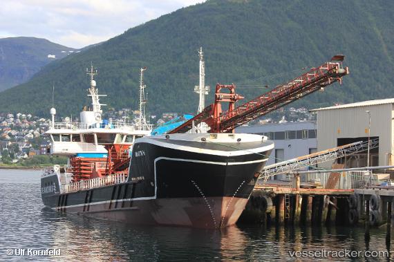
Vessel Martin H IMO: 9639115, MMSI: 257996000 Multi Purpose Carrier
UTC, 68.97852, 15.79667, course: 264, speed: 10.7
UTC, 68.74955, 15.42463, course: 183, speed: 10.8
2026-02-19 19:34:20 UTC, 68.58950, 14.73948, course: 282, speed: 11.4
Live AIS position:
UTC. Near Berrvik (Bergvik)),
updated 2026-02-19 19:34:20 UTC.
Find the position of the vessel Martin H on the map. The latter are known coordinates and path.
marine traffic ship tracker show on live map
The current position of vessel Martin H is 68.58950 lat / 14.73948 lng. Updated: 2026-02-19 19:34:20 UTCCurrently sailing under the flag of Norway
Details:
Last coordinates of the vessel:
UTC, 68.86512, 16.48817, course: 303, speed: 11.7UTC, 68.97852, 15.79667, course: 264, speed: 10.7
UTC, 68.74955, 15.42463, course: 183, speed: 10.8
2026-02-19 19:34:20 UTC, 68.58950, 14.73948, course: 282, speed: 11.4