 vesseltracker.com
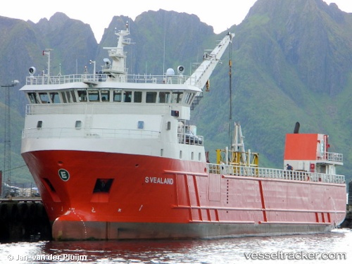
Vessel Svealand IMO: 9390276, MMSI: 259119000 Palletized Cargo Ship
UTC, 64.86079, 11.23991, course: 217, speed: 0
UTC, 64.49805, 10.55401, course: 199, speed: 10.1
2026-01-28 11:47:17 UTC, 64.24744, 10.29202, course: 235, speed: 10.8
Live AIS position:
UTC. Near Brandsfjord),
updated 2026-01-28 11:47:17 UTC.
Find the position of the vessel Svealand on the map. The latter are known coordinates and path.
marine traffic ship tracker show on live map
The current position of vessel Svealand is 64.24744 lat / 10.29202 lng. Updated: 2026-01-28 11:47:17 UTCDetails:
Last coordinates of the vessel:
UTC, 64.86081, 11.24004, course: 217, speed: 0UTC, 64.86079, 11.23991, course: 217, speed: 0
UTC, 64.49805, 10.55401, course: 199, speed: 10.1
2026-01-28 11:47:17 UTC, 64.24744, 10.29202, course: 235, speed: 10.8