 vesseltracker.com
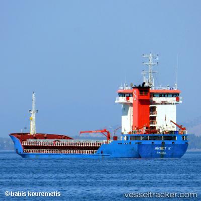
Vessel Hikmet K IMO: 9275854, MMSI: 271000724 General Cargo Ship
UTC, 37.75864, 24.35549, course: -1, speed: 10.5
UTC, 38.02121, 24.71741, course: -1, speed: 10.4
2026-02-27 21:24:20 UTC, 38.14722, 24.86390, course: -1, speed: 10.3
Live AIS position:
UTC. 17 nm N of Gávrion),
updated 2026-02-27 21:24:20 UTC.
Find the position of the vessel Hikmet K on the map. The latter are known coordinates and path.
marine traffic ship tracker show on live map
The current position of vessel Hikmet K is 38.14722 lat / 24.86390 lng. Updated: 2026-02-27 21:24:20 UTCCurrently sailing under the flag of Turkey
Hikmet K built in 2004 year
Deadweight:
5800 tDetails:
Last coordinates of the vessel:
UTC, 37.61253, 23.87399, course: 109, speed: 10.9UTC, 37.75864, 24.35549, course: -1, speed: 10.5
UTC, 38.02121, 24.71741, course: -1, speed: 10.4
2026-02-27 21:24:20 UTC, 38.14722, 24.86390, course: -1, speed: 10.3