 vesseltracker.com
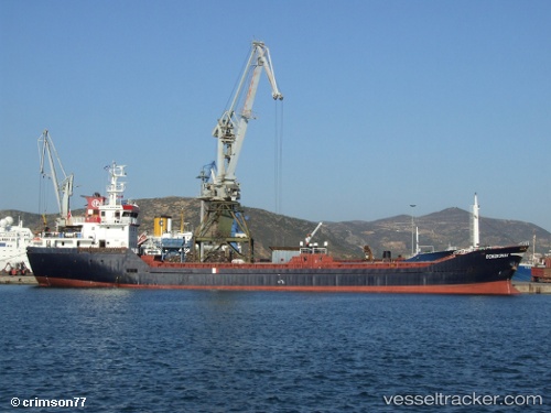
Vessel Denizkonak IMO: 9303895, MMSI: 271000732 General Cargo Ship
UTC, 41.97989, 33.69469, course: 75, speed: 0
UTC, 41.97989, 33.69469, course: 75, speed: 0
2026-01-28 18:24:30 UTC, 42.02237, 33.91334, course: 80, speed: 11.4
Live AIS position:
UTC. Near INEBOLU),
updated 2026-01-28 18:24:30 UTC.
Find the position of the vessel Denizkonak on the map. The latter are known coordinates and path.
marine traffic ship tracker show on live map
The current position of vessel Denizkonak is 42.02237 lat / 33.91334 lng. Updated: 2026-01-28 18:24:30 UTCCurrently sailing under the flag of Turkey
Denizkonak built in 2004 year
Deadweight:
3350 tDetails:
Last coordinates of the vessel:
UTC, 41.97989, 33.69469, course: 75, speed: 0UTC, 41.97989, 33.69469, course: 75, speed: 0
UTC, 41.97989, 33.69469, course: 75, speed: 0
2026-01-28 18:24:30 UTC, 42.02237, 33.91334, course: 80, speed: 11.4