 vesseltracker.com
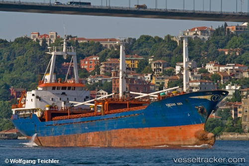
Vessel Hacereana IMO: 7905663, MMSI: 271002075 General Cargo Ship
UTC, 36.83679, 27.37066, course: 179, speed: 8.8
UTC, 36.52632, 27.79788, course: 111, speed: 9.6
2026-01-28 15:28:21 UTC, 36.50415, 27.96278, course: 97, speed: 7.9
Live AIS position:
UTC. Near PANORMITIS),
updated 2026-01-28 15:28:21 UTC.
Find the position of the vessel Hacereana on the map. The latter are known coordinates and path.
marine traffic ship tracker show on live map
The current position of vessel Hacereana is 36.50415 lat / 27.96278 lng. Updated: 2026-01-28 15:28:21 UTCCurrently sailing under the flag of Turkey
Hacereana built in 1980 year
Deadweight:
3178 tDetails:
Last coordinates of the vessel:
UTC, 37.17833, 27.01792, course: 143, speed: 8.8UTC, 36.83679, 27.37066, course: 179, speed: 8.8
UTC, 36.52632, 27.79788, course: 111, speed: 9.6
2026-01-28 15:28:21 UTC, 36.50415, 27.96278, course: 97, speed: 7.9