 vesseltracker.com
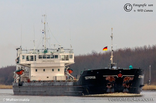
Vessel Sestroretsk IMO: 7801867, MMSI: 273343110 General Cargo Ship
UTC, 37.39750, 23.38033, course: 353, speed: 0.1
UTC, 37.39750, 23.38067, course: 346, speed: 0.1
2026-02-18 15:31:11 UTC, 37.36233, 23.37533, course: 181, speed: 6.7
Live AIS position:
UTC. Near HYDRA),
updated 2026-02-18 15:31:11 UTC.
Find the position of the vessel Sestroretsk on the map. The latter are known coordinates and path.
marine traffic ship tracker show on live map
The current position of vessel Sestroretsk is 37.36233 lat / 23.37533 lng. Updated: 2026-02-18 15:31:11 UTCDetails:
Last coordinates of the vessel:
UTC, 37.39750, 23.38050, course: 348, speed: 0.1UTC, 37.39750, 23.38033, course: 353, speed: 0.1
UTC, 37.39750, 23.38067, course: 346, speed: 0.1
2026-02-18 15:31:11 UTC, 37.36233, 23.37533, course: 181, speed: 6.7