 vesseltracker.com
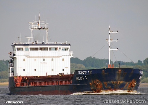
Vessel GELMOND 1 IMO: 9407017, MMSI: 341487000 General Cargo
UTC, 40.46574, 26.76415, course: 32, speed: 0.2
UTC, 40.46574, 26.76415, course: 32, speed: 0.2
2026-02-14 23:29:51 UTC, 40.29889, 26.56324, course: 231, speed: 8.1
Live AIS position:
UTC. Near Gelibolu),
updated 2026-02-14 23:29:51 UTC.
Find the position of the vessel GELMOND 1 on the map. The latter are known coordinates and path.
marine traffic ship tracker show on live map
The current position of vessel GELMOND 1 is 40.29889 lat / 26.56324 lng. Updated: 2026-02-14 23:29:51 UTCCurrently sailing under the flag of St Kitts Nevis
GELMOND 1 built in 2007 year
Deadweight:
3510 tDetails:
Last coordinates of the vessel:
UTC, 40.46569, 26.76368, course: 45, speed: 0.1UTC, 40.46574, 26.76415, course: 32, speed: 0.2
UTC, 40.46574, 26.76415, course: 32, speed: 0.2
2026-02-14 23:29:51 UTC, 40.29889, 26.56324, course: 231, speed: 8.1