 vesseltracker.com
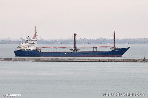
Vessel UMIT G IMO: 9041124, MMSI: 352001539 General Cargo Ship
UTC, 32.81496, 35.03084, course: 336, speed: 0
UTC, 32.81485, 35.03084, course: 339, speed: 0
2026-02-09 17:46:02 UTC, 32.81491, 35.03084, course: 339, speed: 0.2
Live AIS position:
UTC. Near Haifa),
updated 2026-02-09 17:46:02 UTC.
Find the position of the vessel UMIT G on the map. The latter are known coordinates and path.
marine traffic ship tracker show on live map
The current position of vessel UMIT G is 32.81491 lat / 35.03084 lng. Updated: 2026-02-09 17:46:02 UTCCurrently sailing under the flag of Panama
UMIT G built in 1991 year
Deadweight:
4495 tDetails:
Last coordinates of the vessel:
UTC, 32.81491, 35.03082, course: 338, speed: 0UTC, 32.81496, 35.03084, course: 336, speed: 0
UTC, 32.81485, 35.03084, course: 339, speed: 0
2026-02-09 17:46:02 UTC, 32.81491, 35.03084, course: 339, speed: 0.2