 vesseltracker.com
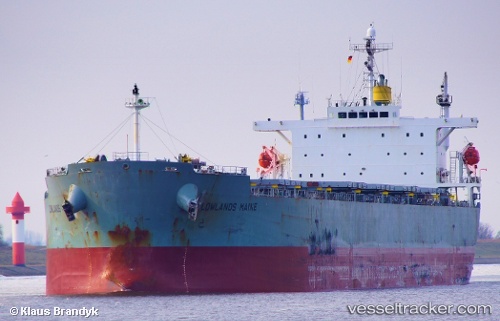
Vessel Lowlands Maine IMO: 9304239, MMSI: 352957000 Bulk Carrier
UTC, 41.48793, 132.09372, course: 188, speed: 11.2
UTC, 38.61090, 131.38910, course: 196, speed: 9.2
2026-02-05 09:05:38 UTC, 38.61090, 131.38910, course: 196, speed: 9.2
Live AIS position:
UTC. 72 nm N of Ulleung-gun),
updated 2026-02-05 09:05:38 UTC.
Find the position of the vessel Lowlands Maine on the map. The latter are known coordinates and path.
marine traffic ship tracker show on live map
The current position of vessel Lowlands Maine is 38.61090 lat / 131.38910 lng. Updated: 2026-02-05 09:05:38 UTCDetails:
Last coordinates of the vessel:
UTC, 41.48793, 132.09372, course: 188, speed: 11.2UTC, 41.48793, 132.09372, course: 188, speed: 11.2
UTC, 38.61090, 131.38910, course: 196, speed: 9.2
2026-02-05 09:05:38 UTC, 38.61090, 131.38910, course: 196, speed: 9.2