 vesseltracker.com
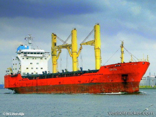
Vessel ABILITY IMO: 9145645, MMSI: 374352000 General Cargo Ship
UTC, 44.14623, 28.64533, course: 355, speed: 0
UTC, 44.14620, 28.64533, course: 355, speed: 0
2026-01-31 13:20:00 UTC, 44.14619, 28.64535, course: 355, speed: 0
Live AIS position:
UTC. Near Constanta),
updated 2026-01-31 13:20:00 UTC.
Find the position of the vessel ABILITY on the map. The latter are known coordinates and path.
marine traffic ship tracker show on live map
The current position of vessel ABILITY is 44.14619 lat / 28.64535 lng. Updated: 2026-01-31 13:20:00 UTCCurrently sailing under the flag of Panama
ABILITY built in 1998 year
Deadweight:
17789 tDetails:
Last coordinates of the vessel:
UTC, 44.14620, 28.64530, course: 355, speed: 0UTC, 44.14623, 28.64533, course: 355, speed: 0
UTC, 44.14620, 28.64533, course: 355, speed: 0
2026-01-31 13:20:00 UTC, 44.14619, 28.64535, course: 355, speed: 0