 vesseltracker.com
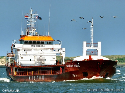
Vessel SEHER S IMO: 9198604, MMSI: 375115000 General Cargo Ship
UTC, 49.84588, -4.26713, course: 235, speed: 7.8
UTC, 49.70760, -4.59000, course: 242, speed: 4.9
2026-01-31 15:46:02 UTC, 49.64143, -4.73867, course: 240, speed: 5.1
Live AIS position:
UTC. 26 nm SE of Cadgwith),
updated 2026-01-31 15:46:02 UTC.
Find the position of the vessel SEHER S on the map. The latter are known coordinates and path.
marine traffic ship tracker show on live map
The current position of vessel SEHER S is 49.64143 lat / -4.73867 lng. Updated: 2026-01-31 15:46:02 UTCCurrently sailing under the flag of St Vincent and Grenadines
SEHER S built in 2001 year
Deadweight:
4247 tDetails:
Last coordinates of the vessel:
UTC, 49.99371, -3.92083, course: 233, speed: 7.8UTC, 49.84588, -4.26713, course: 235, speed: 7.8
UTC, 49.70760, -4.59000, course: 242, speed: 4.9
2026-01-31 15:46:02 UTC, 49.64143, -4.73867, course: 240, speed: 5.1