 vesseltracker.com
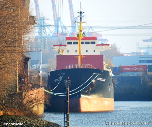
Vessel ALEXIA I IMO: 9365049, MMSI: 538009439 General Cargo Ship
UTC, 32.73333, 27.54667, course: -1, speed: 7
UTC, 32.93333, 27.17667, course: -1, speed: 8
2026-02-28 14:29:09 UTC, 33.10802, 26.84537, course: 298, speed: 7.8
Live AIS position:
UTC. 69 nm SE of Polychnitos Lesvou),
updated 2026-02-28 14:29:09 UTC.
Find the position of the vessel ALEXIA I on the map. The latter are known coordinates and path.
marine traffic ship tracker show on live map
The current position of vessel ALEXIA I is 33.10802 lat / 26.84537 lng. Updated: 2026-02-28 14:29:09 UTCCurrently sailing under the flag of Marshall Islands
ALEXIA I built in 2005 year
Deadweight:
10887 tDetails:
Last coordinates of the vessel:
UTC, 32.59167, 27.81833, course: -1, speed: 7UTC, 32.73333, 27.54667, course: -1, speed: 7
UTC, 32.93333, 27.17667, course: -1, speed: 8
2026-02-28 14:29:09 UTC, 33.10802, 26.84537, course: 298, speed: 7.8