 vesseltracker.com
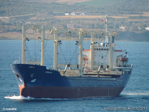
Vessel Merry M IMO: 8418265, MMSI: 620010000 General Cargo Ship
UTC, 34.91696, 35.77748, course: 51, speed: 6.7
UTC, 34.91696, 35.77748, course: 51, speed: 6.7
2026-02-13 05:32:56 UTC, 34.94409, 35.82250, course: 193, speed: 0.4
Live AIS position:
UTC. Near Tartous),
updated 2026-02-13 05:32:56 UTC.
Find the position of the vessel Merry M on the map. The latter are known coordinates and path.
marine traffic ship tracker show on live map
The current position of vessel Merry M is 34.94409 lat / 35.82250 lng. Updated: 2026-02-13 05:32:56 UTCCurrently sailing under the flag of Comoros
Merry M built in 1985 year
Deadweight:
8890 tDetails:
Last coordinates of the vessel:
UTC, 34.91696, 35.77748, course: 51, speed: 6.7UTC, 34.91696, 35.77748, course: 51, speed: 6.7
UTC, 34.91696, 35.77748, course: 51, speed: 6.7
2026-02-13 05:32:56 UTC, 34.94409, 35.82250, course: 193, speed: 0.4