 vesseltracker.com
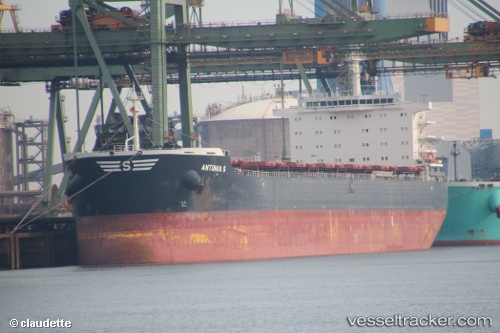
Vessel Antonia S IMO: 9591088, MMSI: 636016295 Bulk Carrier
UTC, 44.36921, 37.76660, course: 36, speed: 6.7
UTC, 44.38586, 37.70758, course: 329, speed: 5
2026-02-28 08:01:33 UTC, 44.38586, 37.70758, course: 329, speed: 5
Live AIS position:
UTC. 17 nm S of Cpc Terminal),
updated 2026-02-28 08:01:33 UTC.
Find the position of the vessel Antonia S on the map. The latter are known coordinates and path.
marine traffic ship tracker show on live map
The current position of vessel Antonia S is 44.38586 lat / 37.70758 lng. Updated: 2026-02-28 08:01:33 UTCDetails:
Last coordinates of the vessel:
UTC, 44.19859, 37.60848, course: 37, speed: 10.7UTC, 44.36921, 37.76660, course: 36, speed: 6.7
UTC, 44.38586, 37.70758, course: 329, speed: 5
2026-02-28 08:01:33 UTC, 44.38586, 37.70758, course: 329, speed: 5