 vesseltracker.com
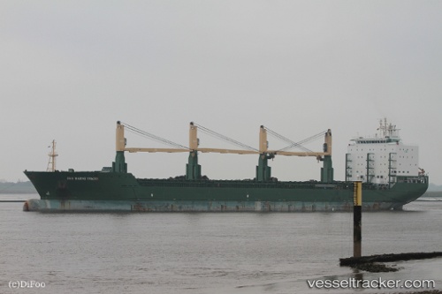
Vessel San Marino Trade IMO: 9509621, MMSI: 636018714 Multi Purpose Carrier
UTC, 35.21762, 129.41216, course: 190, speed: 13.1
UTC, 34.72885, 129.17625, course: 212, speed: 12.8
2026-02-01 09:38:58 UTC, 34.50796, 129.01787, course: 211, speed: 12.7
Live AIS position:
UTC. 23 nm NW of IZUHARA),
updated 2026-02-01 09:38:58 UTC.
Find the position of the vessel San Marino Trade on the map. The latter are known coordinates and path.
marine traffic ship tracker show on live map
The current position of vessel San Marino Trade is 34.50796 lat / 129.01787 lng. Updated: 2026-02-01 09:38:58 UTCDetails:
Last coordinates of the vessel:
UTC, 35.51459, 129.38603, course: 359, speed: 0UTC, 35.21762, 129.41216, course: 190, speed: 13.1
UTC, 34.72885, 129.17625, course: 212, speed: 12.8
2026-02-01 09:38:58 UTC, 34.50796, 129.01787, course: 211, speed: 12.7