 vesseltracker.com
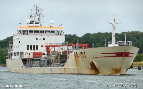
Vessel MERA IMO: 9148570, MMSI: 636021892 Oil/Chemical Tanker
UTC, -65.44222, 22.65695, course: 32, speed: 38.2
2026-02-05 03:07:02 UTC, -65.44222, 22.65695, course: 32, speed: 38.2
Live AIS position:
UTC. 400 nm NE of Novolazarevskaya),
updated 2026-02-05 03:07:02 UTC.
Find the position of the vessel MERA on the map. The latter are known coordinates and path.
marine traffic ship tracker show on live map
The current position of vessel MERA is -65.44222 lat / 22.65695 lng. Updated: 2026-02-05 03:07:02 UTCCurrently sailing under the flag of Liberia
MERA built in 1998 year
Deadweight:
7014 tDetails:
Last coordinates of the vessel:
UTC, -65.44222, 22.65695, course: 32, speed: 38.2UTC, -65.44222, 22.65695, course: 32, speed: 38.2
2026-02-05 03:07:02 UTC, -65.44222, 22.65695, course: 32, speed: 38.2