 vesseltracker.com
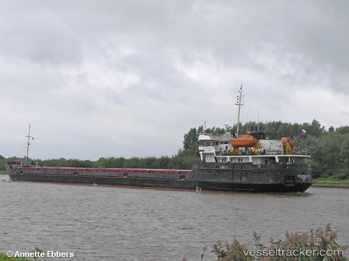
Vessel Verlaine IMO: 8841694, MMSI: 677080700 General Cargo Ship
UTC, 38.85572, 26.90348, course: 59, speed: 0.1
UTC, 38.85674, 26.90355, course: 124, speed: 0
2026-02-18 15:33:59 UTC, 38.85659, 26.90350, course: 115, speed: 0.2
Live AIS position:
UTC. Near Aliaga),
updated 2026-02-18 15:33:59 UTC.
Find the position of the vessel Verlaine on the map. The latter are known coordinates and path.
marine traffic ship tracker show on live map
The current position of vessel Verlaine is 38.85659 lat / 26.90350 lng. Updated: 2026-02-18 15:33:59 UTCCurrently sailing under the flag of Tanzania
Verlaine built in 1980 year
Deadweight:
2893 tDetails:
Last coordinates of the vessel:
UTC, 38.85522, 26.90459, course: 1, speed: 0.2UTC, 38.85572, 26.90348, course: 59, speed: 0.1
UTC, 38.85674, 26.90355, course: 124, speed: 0
2026-02-18 15:33:59 UTC, 38.85659, 26.90350, course: 115, speed: 0.2