 vesseltracker.com
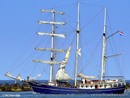
Vessel Thalassa IMO: 8101276, MMSI: 246329000 Cruise Ship
UTC, 17.06500, -82.40833, course: -1, speed: 6
UTC, 17.18333, -82.63167, course: -1, speed: 6
2026-02-12 17:35:21 UTC, 17.29500, -82.80500, course: -1, speed: 6
Live AIS position:
UTC. 66 nm E of Swan Island),
updated 2026-02-12 17:35:21 UTC.
Find the position of the vessel Thalassa on the map. The latter are known coordinates and path.
marine traffic ship tracker show on live map
The current position of vessel Thalassa is 17.29500 lat / -82.80500 lng. Updated: 2026-02-12 17:35:21 UTCCurrently sailing under the flag of Netherlands
Thalassa built in 1980 year
Details:
Last coordinates of the vessel:
UTC, 16.92667, -82.23333, course: -1, speed: 5UTC, 17.06500, -82.40833, course: -1, speed: 6
UTC, 17.18333, -82.63167, course: -1, speed: 6
2026-02-12 17:35:21 UTC, 17.29500, -82.80500, course: -1, speed: 6