 vesseltracker.com
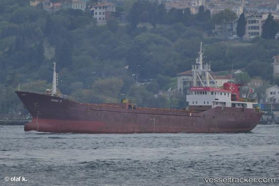
Vessel Banu S IMO: 8301060, MMSI: 271002040 General Cargo Ship
UTC, 40.66776, 27.65804, course: 74, speed: 0.2
UTC, 40.66800, 27.65790, course: 88, speed: 0.1
2026-02-11 17:48:18 UTC, 40.66790, 27.65781, course: 85, speed: 0.1
Live AIS position:
UTC. Near Saraylar),
updated 2026-02-11 17:48:18 UTC.
Find the position of the vessel Banu S on the map. The latter are known coordinates and path.
marine traffic ship tracker show on live map
The current position of vessel Banu S is 40.66790 lat / 27.65781 lng. Updated: 2026-02-11 17:48:18 UTCCurrently sailing under the flag of Turkey
Details:
Last coordinates of the vessel:
UTC, 40.66746, 27.65836, course: 45, speed: 0.1UTC, 40.66776, 27.65804, course: 74, speed: 0.2
UTC, 40.66800, 27.65790, course: 88, speed: 0.1
2026-02-11 17:48:18 UTC, 40.66790, 27.65781, course: 85, speed: 0.1