 vesseltracker.com
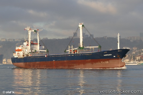
Vessel Elif S IMO: 8517293, MMSI: 620088000 General Cargo Ship
UTC, 15.50295, 53.29126, course: -1, speed: 8.3
UTC, 15.50295, 53.29126, course: -1, speed: 8.3
2026-02-08 02:27:15 UTC, 15.50295, 53.29126, course: -1, speed: 8.3
Live AIS position:
UTC. 97 nm SW of Port Raysut),
updated 2026-02-08 02:27:15 UTC.
Find the position of the vessel Elif S on the map. The latter are known coordinates and path.
marine traffic ship tracker show on live map
The current position of vessel Elif S is 15.50295 lat / 53.29126 lng. Updated: 2026-02-08 02:27:15 UTCCurrently sailing under the flag of Comoros
Elif S built in 1985 year
Deadweight:
8150 tDetails:
Last coordinates of the vessel:
UTC, 14.32903, 52.70026, course: -1, speed: 8.4UTC, 15.50295, 53.29126, course: -1, speed: 8.3
UTC, 15.50295, 53.29126, course: -1, speed: 8.3
2026-02-08 02:27:15 UTC, 15.50295, 53.29126, course: -1, speed: 8.3