 vesseltracker.com
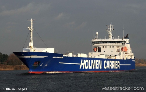
Vessel Transporter IMO: 8820858, MMSI: 230684000 Ro Ro Cargo Ship
UTC, 52.54238, 2.02089, course: 330, speed: 14
UTC, 52.77161, 1.89815, course: 311, speed: 11.4
2026-02-20 22:11:40 UTC, 53.10873, 1.38981, course: 322, speed: 13.1
Live AIS position:
UTC. 11 nm N of Cromer),
updated 2026-02-20 22:11:40 UTC.
Find the position of the vessel Transporter on the map. The latter are known coordinates and path.
marine traffic ship tracker show on live map
The current position of vessel Transporter is 53.10873 lat / 1.38981 lng. Updated: 2026-02-20 22:11:40 UTCCurrently sailing under the flag of Finland
Transporter built in 1991 year
Deadweight:
5387 tDetails:
Last coordinates of the vessel:
UTC, 52.07599, 2.37506, course: 348, speed: 16.2UTC, 52.54238, 2.02089, course: 330, speed: 14
UTC, 52.77161, 1.89815, course: 311, speed: 11.4
2026-02-20 22:11:40 UTC, 53.10873, 1.38981, course: 322, speed: 13.1