 vesseltracker.com
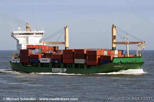
Vessel Natalia A IMO: 9020352, MMSI: 271042494 Container Ship
UTC, 37.05987, 3.33884, course: 81, speed: 10.8
UTC, 37.05987, 3.33884, course: 81, speed: 10.8
2026-01-14 08:23:03 UTC, 37.05987, 3.33884, course: 81, speed: 10.8
Live AIS position:
UTC. 17 nm N of Ain Taya),
updated 2026-01-14 08:23:03 UTC.
Find the position of the vessel Natalia A on the map. The latter are known coordinates and path.
marine traffic ship tracker show on live map
The current position of vessel Natalia A is 37.05987 lat / 3.33884 lng. Updated: 2026-01-14 08:23:03 UTCCurrently sailing under the flag of Turkey
Natalia A built in 1993 year
Deadweight:
12184 tDetails:
Last coordinates of the vessel:
UTC, 37.05987, 3.33884, course: 81, speed: 10.8UTC, 37.05987, 3.33884, course: 81, speed: 10.8
UTC, 37.05987, 3.33884, course: 81, speed: 10.8
2026-01-14 08:23:03 UTC, 37.05987, 3.33884, course: 81, speed: 10.8