 vesseltracker.com
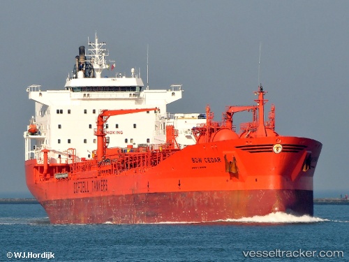
Vessel BOW CEDAR IMO: 9087013, MMSI: 538009688 Chemical/Oil Products Tanker
UTC, -52.52183, -169.19357, course: -1, speed: 31.9
UTC, -52.52183, -169.19357, course: -1, speed: 31.9
2026-02-17 08:15:26 UTC, -52.52183, -169.19357, course: -1, speed: 31.9
Live AIS position:
UTC. Open sea (no nearby ports in database)),
updated 2026-02-17 08:15:26 UTC.
Find the position of the vessel BOW CEDAR on the map. The latter are known coordinates and path.
marine traffic ship tracker show on live map
The current position of vessel BOW CEDAR is -52.52183 lat / -169.19357 lng. Updated: 2026-02-17 08:15:26 UTCCurrently sailing under the flag of Marshall Islands
BOW CEDAR built in 1996 year
Deadweight:
37455 tDetails:
Last coordinates of the vessel:
UTC, -81.76098, -160.36189, course: -1, speed: 63.9UTC, -52.52183, -169.19357, course: -1, speed: 31.9
UTC, -52.52183, -169.19357, course: -1, speed: 31.9
2026-02-17 08:15:26 UTC, -52.52183, -169.19357, course: -1, speed: 31.9