 vesseltracker.com
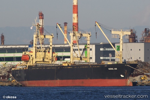
Vessel Dong An IMO: 9119191, MMSI: 574266000 General Cargo Ship
UTC, 18.97547, 105.77808, course: 16, speed: 11.7
UTC, 19.26862, 105.86177, course: 330, speed: 6.1
2026-02-13 18:01:44 UTC, 19.26862, 105.86177, course: 330, speed: 6.1
Live AIS position:
UTC. Near Nghi Son),
updated 2026-02-13 18:01:44 UTC.
Find the position of the vessel Dong An on the map. The latter are known coordinates and path.
marine traffic ship tracker show on live map
The current position of vessel Dong An is 19.26862 lat / 105.86177 lng. Updated: 2026-02-13 18:01:44 UTCCurrently sailing under the flag of Vietnam
Dong An built in 1995 year
Deadweight:
7091 tDetails:
Last coordinates of the vessel:
UTC, 18.85096, 105.71485, course: 57, speed: 0UTC, 18.97547, 105.77808, course: 16, speed: 11.7
UTC, 19.26862, 105.86177, course: 330, speed: 6.1
2026-02-13 18:01:44 UTC, 19.26862, 105.86177, course: 330, speed: 6.1