 vesseltracker.com
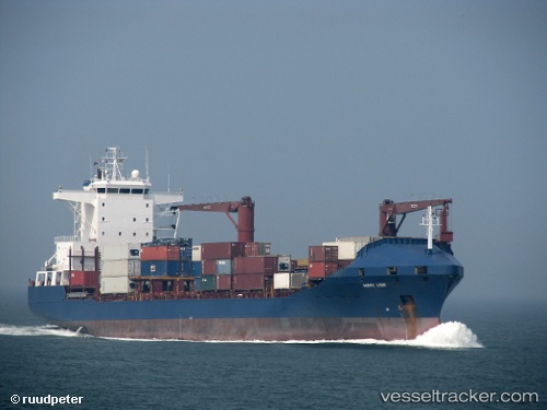
Vessel Roseline A IMO: 9163984, MMSI: 271043491 Container Ship
UTC, 36.76416, 3.13782, course: 282, speed: 0.1
UTC, 36.76436, 3.13805, course: 276, speed: 0.2
2026-02-11 03:52:56 UTC, 36.76427, 3.13807, course: 273, speed: 0.2
Live AIS position:
UTC. Near Mohammadia),
updated 2026-02-11 03:52:56 UTC.
Find the position of the vessel Roseline A on the map. The latter are known coordinates and path.
marine traffic ship tracker show on live map
The current position of vessel Roseline A is 36.76427 lat / 3.13807 lng. Updated: 2026-02-11 03:52:56 UTCCurrently sailing under the flag of Turkey
Roseline A built in 1998 year
Deadweight:
16727 tDetails:
Last coordinates of the vessel:
UTC, 36.76505, 3.13784, course: 249, speed: 0.2UTC, 36.76416, 3.13782, course: 282, speed: 0.1
UTC, 36.76436, 3.13805, course: 276, speed: 0.2
2026-02-11 03:52:56 UTC, 36.76427, 3.13807, course: 273, speed: 0.2