 vesseltracker.com
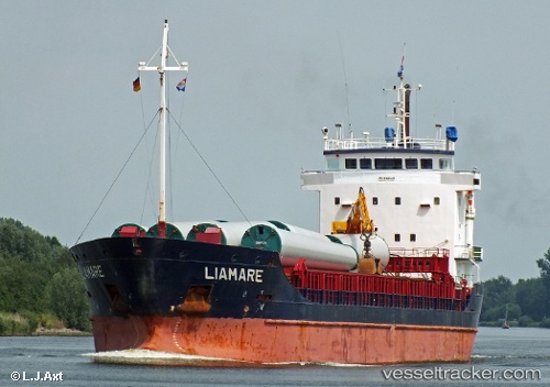
Vessel Liamare IMO: 9166481, MMSI: 245455000 General Cargo Ship
UTC, 58.32535, 6.35055, course: -1, speed: 0
UTC, 58.32537, 6.35053, course: -1, speed: 0
2026-02-28 06:00:52 UTC, 58.32508, 6.35062, course: -1, speed: 0
Live AIS position:
UTC. Near Jøssingfjord),
updated 2026-02-28 06:00:52 UTC.
Find the position of the vessel Liamare on the map. The latter are known coordinates and path.
marine traffic ship tracker show on live map
The current position of vessel Liamare is 58.32508 lat / 6.35062 lng. Updated: 2026-02-28 06:00:52 UTCCurrently sailing under the flag of Netherlands
Liamare built in 2001 year
Deadweight:
5842 tDetails:
Last coordinates of the vessel:
UTC, 58.32537, 6.35056, course: 355, speed: 0.1UTC, 58.32535, 6.35055, course: -1, speed: 0
UTC, 58.32537, 6.35053, course: -1, speed: 0
2026-02-28 06:00:52 UTC, 58.32508, 6.35062, course: -1, speed: 0