 vesseltracker.com
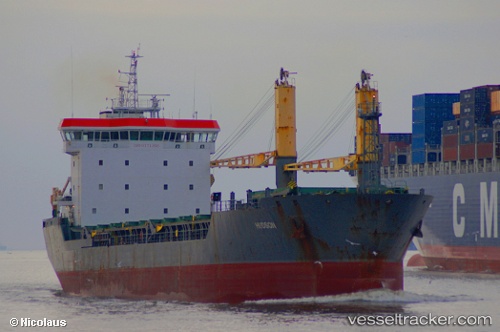
Vessel IMMENSITY IMO: 9171395, MMSI: 351760000 General Cargo Ship
UTC, 36.44183, 19.63401, course: 274, speed: 10.2
UTC, 36.46961, 18.54395, course: 277, speed: 10.7
2026-02-25 01:31:49 UTC, 36.48694, 18.08196, course: 270, speed: 10.7
Live AIS position:
UTC. 86 nm NE of Ryuo),
updated 2026-02-25 01:31:49 UTC.
Find the position of the vessel IMMENSITY on the map. The latter are known coordinates and path.
marine traffic ship tracker show on live map
The current position of vessel IMMENSITY is 36.48694 lat / 18.08196 lng. Updated: 2026-02-25 01:31:49 UTCCurrently sailing under the flag of Panama
IMMENSITY built in 2002 year
Deadweight:
9766 tDetails:
Last coordinates of the vessel:
UTC, 36.44183, 19.63401, course: 274, speed: 10.2UTC, 36.44183, 19.63401, course: 274, speed: 10.2
UTC, 36.46961, 18.54395, course: 277, speed: 10.7
2026-02-25 01:31:49 UTC, 36.48694, 18.08196, course: 270, speed: 10.7