 vesseltracker.com
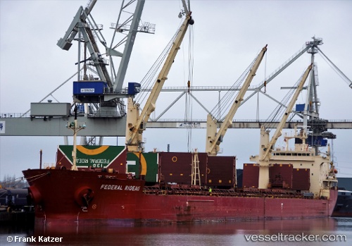
Vessel Federal Rideau IMO: 9200445, MMSI: 538006784 Bulk Carrier
UTC, 51.42113, 3.53298, course: 85, speed: 3.3
UTC, 51.42113, 3.53298, course: 85, speed: 3.3
UTC, 3.90121, -179.54398, course: 230, speed: 31.9
UTC, 3.90121, -179.54398, course: 230, speed: 31.9
2026-02-02 02:24:43 UTC, 3.90121, -179.54398, course: 230, speed: 31.9
Live AIS position:
UTC. 255 nm NW of Howland Island),
updated 2026-02-02 02:24:43 UTC.
Find the position of the vessel Federal Rideau on the map. The latter are known coordinates and path.
marine traffic ship tracker show on live map
The current position of vessel Federal Rideau is 3.90121 lat / -179.54398 lng. Updated: 2026-02-02 02:24:43 UTCCurrently sailing under the flag of Marshall Is
Federal Rideau built in 2000 year
Deadweight:
36563 tDetails:
Last coordinates of the vessel:
UTC, 51.42113, 3.53298, course: 85, speed: 3.3UTC, 51.42113, 3.53298, course: 85, speed: 3.3
UTC, 51.42113, 3.53298, course: 85, speed: 3.3
UTC, 3.90121, -179.54398, course: 230, speed: 31.9
UTC, 3.90121, -179.54398, course: 230, speed: 31.9
2026-02-02 02:24:43 UTC, 3.90121, -179.54398, course: 230, speed: 31.9