 vesseltracker.com
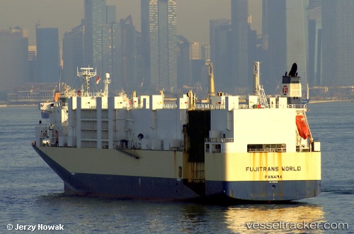
Vessel Fujitrans World IMO: 9210000, MMSI: 636016327 Vehicles Carrier
UTC, 22.78270, 117.18236, course: 51, speed: 15.1
UTC, 23.15090, 117.67678, course: 50, speed: 16.1
2026-01-29 08:17:10 UTC, 23.50907, 118.21845, course: 56, speed: 16.3
Live AIS position:
UTC. 30 nm E of Nanao Pt),
updated 2026-01-29 08:17:10 UTC.
Find the position of the vessel Fujitrans World on the map. The latter are known coordinates and path.
marine traffic ship tracker show on live map
The current position of vessel Fujitrans World is 23.50907 lat / 118.21845 lng. Updated: 2026-01-29 08:17:10 UTCCurrently sailing under the flag of Liberia
Fujitrans World built in 2000 year
Deadweight:
9653 tDetails:
Last coordinates of the vessel:
UTC, 22.65422, 116.84321, course: 67, speed: 14.8UTC, 22.78270, 117.18236, course: 51, speed: 15.1
UTC, 23.15090, 117.67678, course: 50, speed: 16.1
2026-01-29 08:17:10 UTC, 23.50907, 118.21845, course: 56, speed: 16.3