 vesseltracker.com
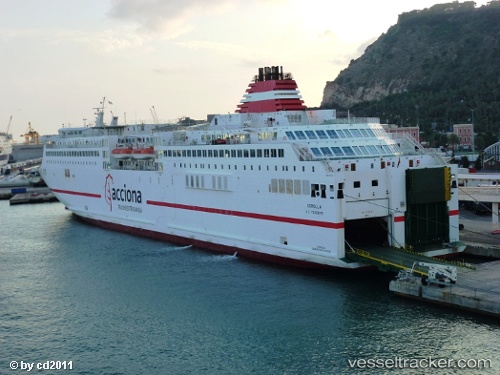
Vessel Ciudad De Granada IMO: 9217125, MMSI: 224600000 Passenger Ro Ro Cargo Ship
UTC, 38.90612, 1.45036, course: 259, speed: 0
UTC, 38.90613, 1.45036, course: 259, speed: 0
2026-02-25 12:01:20 UTC, 38.83073, 1.21192, course: 293, speed: 15.9
Live AIS position:
UTC. Near Sant Josep de sa Talaia),
updated 2026-02-25 12:01:20 UTC.
Find the position of the vessel Ciudad De Granada on the map. The latter are known coordinates and path.
marine traffic ship tracker show on live map
The current position of vessel Ciudad De Granada is 38.83073 lat / 1.21192 lng. Updated: 2026-02-25 12:01:20 UTCCurrently sailing under the flag of Spain
Ciudad De Granada built in 2001 year
Deadweight:
5000 tDetails:
Last coordinates of the vessel:
UTC, 38.90616, 1.45034, course: 259, speed: 0UTC, 38.90612, 1.45036, course: 259, speed: 0
UTC, 38.90613, 1.45036, course: 259, speed: 0
2026-02-25 12:01:20 UTC, 38.83073, 1.21192, course: 293, speed: 15.9