 vesseltracker.com
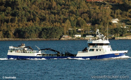
Vessel Rohav IMO: 9220677, MMSI: 259584000 Fish Carrier
UTC, 61.70656, 4.91165, course: 192, speed: 0
UTC, 61.70774, 4.91364, course: 142, speed: 1.9
2026-02-26 10:03:34 UTC, 61.60243, 5.03480, course: 89, speed: 0
Live AIS position:
UTC. Near FLORO),
updated 2026-02-26 10:03:34 UTC.
Find the position of the vessel Rohav on the map. The latter are known coordinates and path.
marine traffic ship tracker show on live map
The current position of vessel Rohav is 61.60243 lat / 5.03480 lng. Updated: 2026-02-26 10:03:34 UTCCurrently sailing under the flag of Norway
Rohav built in 2002 year
Deadweight:
650 tDetails:
Last coordinates of the vessel:
UTC, 61.60155, 5.02179, course: 278, speed: 0UTC, 61.70656, 4.91165, course: 192, speed: 0
UTC, 61.70774, 4.91364, course: 142, speed: 1.9
2026-02-26 10:03:34 UTC, 61.60243, 5.03480, course: 89, speed: 0