 vesseltracker.com
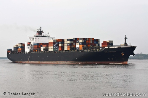
Vessel Catherine C IMO: 9229300, MMSI: 636017173 Container Ship
UTC, -4.24519, 39.98387, course: 29, speed: 0.8
UTC, -4.24533, 39.98730, course: 343, speed: 0.4
2026-02-14 17:27:08 UTC, -4.30077, 40.00417, course: 344, speed: 0.9
Live AIS position:
UTC. 24 nm SE of Mombasa),
updated 2026-02-14 17:27:08 UTC.
Find the position of the vessel Catherine C on the map. The latter are known coordinates and path.
marine traffic ship tracker show on live map
The current position of vessel Catherine C is -4.30077 lat / 40.00417 lng. Updated: 2026-02-14 17:27:08 UTCCurrently sailing under the flag of Liberia
Catherine C built in 2001 year
Deadweight:
77900 tDetails:
Last coordinates of the vessel:
UTC, -4.28465, 40.10472, course: 273, speed: 4.7UTC, -4.24519, 39.98387, course: 29, speed: 0.8
UTC, -4.24533, 39.98730, course: 343, speed: 0.4
2026-02-14 17:27:08 UTC, -4.30077, 40.00417, course: 344, speed: 0.9