 vesseltracker.com
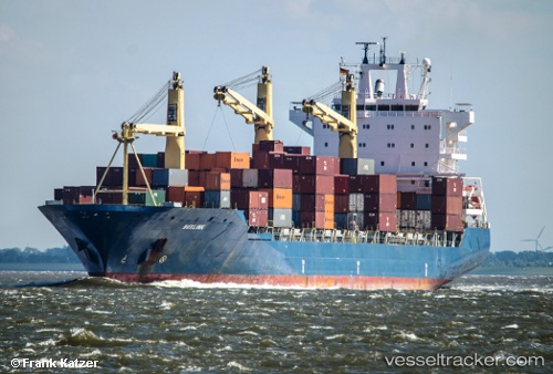
Vessel Buxlink IMO: 9235816, MMSI: 636091785 Container Ship
UTC, 31.24162, 32.30215, course: 184, speed: 0
UTC, 31.24162, 32.30217, course: 184, speed: 0
2026-02-21 07:26:44 UTC, 31.24162, 32.30215, course: 184, speed: 0
Live AIS position:
UTC. Near Port Said West),
updated 2026-02-21 07:26:44 UTC.
Find the position of the vessel Buxlink on the map. The latter are known coordinates and path.
marine traffic ship tracker show on live map
The current position of vessel Buxlink is 31.24162 lat / 32.30215 lng. Updated: 2026-02-21 07:26:44 UTCDetails:
Last coordinates of the vessel:
UTC, 31.24160, 32.30217, course: 184, speed: 0UTC, 31.24162, 32.30215, course: 184, speed: 0
UTC, 31.24162, 32.30217, course: 184, speed: 0
2026-02-21 07:26:44 UTC, 31.24162, 32.30215, course: 184, speed: 0