 vesseltracker.com
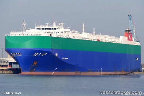
Vessel Onyx Arrow IMO: 9267924, MMSI: 311918000 Vehicles Carrier
UTC, 19.54118, 164.32277, course: 294, speed: 18.7
UTC, 19.82833, 163.64833, course: -1, speed: 18
2026-02-05 01:39:24 UTC, 20.09951, 163.06517, course: 293, speed: 18.2
Live AIS position:
UTC. 205 nm W of Wake Island),
updated 2026-02-05 01:39:24 UTC.
Find the position of the vessel Onyx Arrow on the map. The latter are known coordinates and path.
marine traffic ship tracker show on live map
The current position of vessel Onyx Arrow is 20.09951 lat / 163.06517 lng. Updated: 2026-02-05 01:39:24 UTCDetails:
Last coordinates of the vessel:
UTC, 19.34654, 164.77809, course: 295, speed: 18.2UTC, 19.54118, 164.32277, course: 294, speed: 18.7
UTC, 19.82833, 163.64833, course: -1, speed: 18
2026-02-05 01:39:24 UTC, 20.09951, 163.06517, course: 293, speed: 18.2