 vesseltracker.com
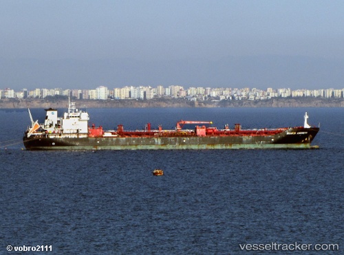
Vessel M K A IMO: 9269403, MMSI: 518998516 Chemical/Oil Products Tanker
UTC, 25.40967, 56.48233, course: 154, speed: 0
UTC, 25.40967, 56.48233, course: 154, speed: 0
2026-02-06 15:21:15 UTC, 25.40967, 56.48233, course: 154, speed: 0
Live AIS position:
UTC. Near KHORFAKKAN),
updated 2026-02-06 15:21:15 UTC.
Find the position of the vessel M K A on the map. The latter are known coordinates and path.
marine traffic ship tracker show on live map
The current position of vessel M K A is 25.40967 lat / 56.48233 lng. Updated: 2026-02-06 15:21:15 UTCCurrently sailing under the flag of Cook islands
M K A built in 2003 year
Deadweight:
29524 tDetails:
Last coordinates of the vessel:
UTC, 25.40950, 56.48233, course: 149, speed: 0UTC, 25.40967, 56.48233, course: 154, speed: 0
UTC, 25.40967, 56.48233, course: 154, speed: 0
2026-02-06 15:21:15 UTC, 25.40967, 56.48233, course: 154, speed: 0