 vesseltracker.com
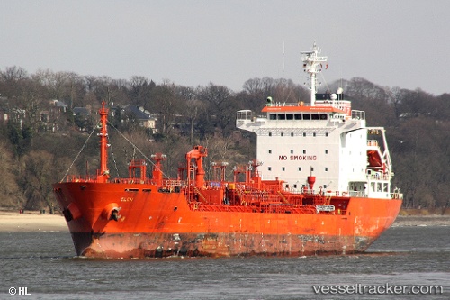
Vessel K INSET IMO: 9311634, MMSI: 636022086 Chemical/Oil Products Tanker
UTC, 36.91670, 6.92655, course: 327, speed: 0.2
UTC, 36.91672, 6.92678, course: 312, speed: 0.1
2026-02-17 23:34:40 UTC, 36.91665, 6.92650, course: 332, speed: 0.2
Live AIS position:
UTC. Near Skikda),
updated 2026-02-17 23:34:40 UTC.
Find the position of the vessel K INSET on the map. The latter are known coordinates and path.
marine traffic ship tracker show on live map
The current position of vessel K INSET is 36.91665 lat / 6.92650 lng. Updated: 2026-02-17 23:34:40 UTCCurrently sailing under the flag of Liberia
K INSET built in 2005 year
Deadweight:
12956 tDetails:
Last coordinates of the vessel:
UTC, 36.91670, 6.92647, course: 334, speed: 0.1UTC, 36.91670, 6.92655, course: 327, speed: 0.2
UTC, 36.91672, 6.92678, course: 312, speed: 0.1
2026-02-17 23:34:40 UTC, 36.91665, 6.92650, course: 332, speed: 0.2