 vesseltracker.com
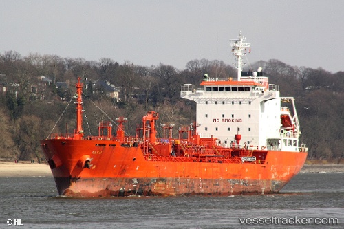
Vessel K INSET IMO: 9311634, MMSI: 636022086 Chemical/Oil Products Tanker
UTC, 37.06632, 6.90448, course: 300, speed: 1
UTC, 37.09762, 6.88752, course: 291, speed: 1.6
2026-01-31 11:23:19 UTC, 37.13133, 6.85893, course: 299, speed: 2.5
Live AIS position:
UTC. 15 nm N of Skikda),
updated 2026-01-31 11:23:19 UTC.
Find the position of the vessel K INSET on the map. The latter are known coordinates and path.
marine traffic ship tracker show on live map
The current position of vessel K INSET is 37.13133 lat / 6.85893 lng. Updated: 2026-01-31 11:23:19 UTCCurrently sailing under the flag of Liberia
K INSET built in 2005 year
Deadweight:
12956 tDetails:
Last coordinates of the vessel:
UTC, 37.08693, 6.97413, course: 172, speed: 1.8UTC, 37.06632, 6.90448, course: 300, speed: 1
UTC, 37.09762, 6.88752, course: 291, speed: 1.6
2026-01-31 11:23:19 UTC, 37.13133, 6.85893, course: 299, speed: 2.5