 vesseltracker.com
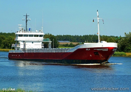
Vessel Mila IMO: 9331335, MMSI: 246542000 General Cargo Ship
UTC, 53.91234, 9.18169, course: 226, speed: 0
UTC, 53.89339, 9.14949, course: 218, speed: 1.4
2026-03-01 14:05:54 UTC, 53.96968, 8.55596, course: 274, speed: 12.8
Live AIS position:
UTC. Near Cuxhaven),
updated 2026-03-01 14:05:54 UTC.
Find the position of the vessel Mila on the map. The latter are known coordinates and path.
marine traffic ship tracker show on live map
The current position of vessel Mila is 53.96968 lat / 8.55596 lng. Updated: 2026-03-01 14:05:54 UTCDetails:
Last coordinates of the vessel:
UTC, 53.92864, 9.20540, course: 216, speed: 6.4UTC, 53.91234, 9.18169, course: 226, speed: 0
UTC, 53.89339, 9.14949, course: 218, speed: 1.4
2026-03-01 14:05:54 UTC, 53.96968, 8.55596, course: 274, speed: 12.8