 vesseltracker.com
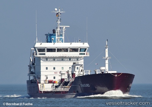
Vessel Orasund IMO: 9336701, MMSI: 220514000 Chemical Oil Products Tanker
UTC, 55.74752, 10.64401, course: 255, speed: 14.3
UTC, 56.13797, 10.28876, course: 333, speed: 8.8
2026-02-05 19:20:54 UTC, 56.14804, 10.22427, course: 36, speed: 0
Live AIS position:
UTC. Near Aarhus),
updated 2026-02-05 19:20:54 UTC.
Find the position of the vessel Orasund on the map. The latter are known coordinates and path.
marine traffic ship tracker show on live map
The current position of vessel Orasund is 56.14804 lat / 10.22427 lng. Updated: 2026-02-05 19:20:54 UTCCurrently sailing under the flag of Denmark
Orasund built in 2008 year
Deadweight:
4975 tDetails:
Last coordinates of the vessel:
UTC, 55.56334, 10.85250, course: 338, speed: 14.6UTC, 55.74752, 10.64401, course: 255, speed: 14.3
UTC, 56.13797, 10.28876, course: 333, speed: 8.8
2026-02-05 19:20:54 UTC, 56.14804, 10.22427, course: 36, speed: 0