 vesseltracker.com
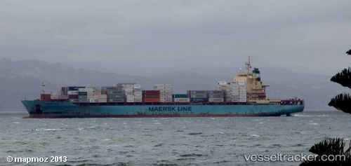
Vessel Sine A IMO: 9343089, MMSI: 256318000 Container Ship
UTC, 36.31333, -12.66167, course: -1, speed: 19
UTC, 36.30568, -12.33554, course: 90, speed: 19.7
2026-01-19 18:27:39 UTC, 36.29500, -11.95500, course: -1, speed: 19
Live AIS position:
UTC. 127 nm SW of Los Ramos),
updated 2026-01-19 18:27:39 UTC.
Find the position of the vessel Sine A on the map. The latter are known coordinates and path.
marine traffic ship tracker show on live map
The current position of vessel Sine A is 36.29500 lat / -11.95500 lng. Updated: 2026-01-19 18:27:39 UTCCurrently sailing under the flag of Malta
Sine A built in 2008 year
Deadweight:
39426 tDetails:
Last coordinates of the vessel:
UTC, 36.32167, -13.10833, course: -1, speed: 19UTC, 36.31333, -12.66167, course: -1, speed: 19
UTC, 36.30568, -12.33554, course: 90, speed: 19.7
2026-01-19 18:27:39 UTC, 36.29500, -11.95500, course: -1, speed: 19