 vesseltracker.com
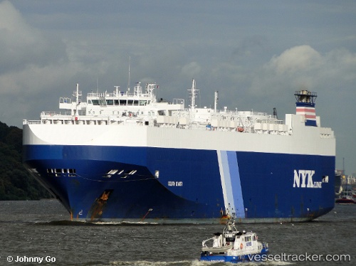
Vessel Goliath Leader IMO: 9357315, MMSI: 308369000 Vehicles Carrier
UTC, 35.03043, 136.79655, course: 298, speed: 0
UTC, 35.02529, 136.79651, course: 126, speed: 5.5
2026-02-09 08:12:21 UTC, 34.54760, 137.02065, course: 134, speed: 9.6
Live AIS position:
UTC. Near Atumi),
updated 2026-02-09 08:12:21 UTC.
Find the position of the vessel Goliath Leader on the map. The latter are known coordinates and path.
marine traffic ship tracker show on live map
The current position of vessel Goliath Leader is 34.54760 lat / 137.02065 lng. Updated: 2026-02-09 08:12:21 UTCDetails:
Last coordinates of the vessel:
UTC, 35.03048, 136.79648, course: 297, speed: 0UTC, 35.03043, 136.79655, course: 298, speed: 0
UTC, 35.02529, 136.79651, course: 126, speed: 5.5
2026-02-09 08:12:21 UTC, 34.54760, 137.02065, course: 134, speed: 9.6