 vesseltracker.com
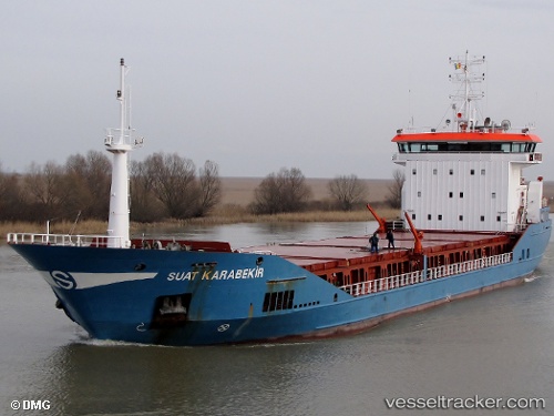
Vessel SUAT KARABEKIR IMO: 9391452, MMSI: 351630000 General Cargo Ship
UTC, 44.15777, 28.65655, course: -1, speed: 0
UTC, 44.15779, 28.65657, course: -1, speed: 0
2026-02-28 11:59:17 UTC, 44.15796, 28.65660, course: -1, speed: 0
Live AIS position:
UTC. Near Constanta),
updated 2026-02-28 11:59:17 UTC.
Find the position of the vessel SUAT KARABEKIR on the map. The latter are known coordinates and path.
marine traffic ship tracker show on live map
The current position of vessel SUAT KARABEKIR is 44.15796 lat / 28.65660 lng. Updated: 2026-02-28 11:59:17 UTCCurrently sailing under the flag of Panama
SUAT KARABEKIR built in 2008 year
Deadweight:
7208 tDetails:
Last coordinates of the vessel:
UTC, 44.15774, 28.65656, course: -1, speed: 0UTC, 44.15777, 28.65655, course: -1, speed: 0
UTC, 44.15779, 28.65657, course: -1, speed: 0
2026-02-28 11:59:17 UTC, 44.15796, 28.65660, course: -1, speed: 0