 vesseltracker.com
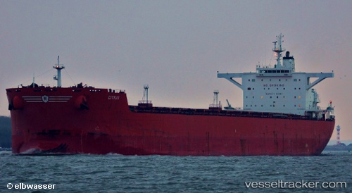
Vessel Citius IMO: 9398694, MMSI: 235074589 Bulk Carrier
UTC, 1.43470, -119.84878, course: 270, speed: 10.8
UTC, 1.44012, -120.23705, course: 274, speed: 11.1
2026-02-01 03:56:01 UTC, 1.45993, -120.58434, course: 270, speed: 11.1
Live AIS position:
UTC. 240 nm E of Amurang),
updated 2026-02-01 03:56:01 UTC.
Find the position of the vessel Citius on the map. The latter are known coordinates and path.
marine traffic ship tracker show on live map
The current position of vessel Citius is 1.45993 lat / -120.58434 lng. Updated: 2026-02-01 03:56:01 UTCCurrently sailing under the flag of United Kingdom
Citius built in 2010 year
Deadweight:
170024 tDetails:
Last coordinates of the vessel:
UTC, 1.42167, -119.56167, course: -1, speed: 10UTC, 1.43470, -119.84878, course: 270, speed: 10.8
UTC, 1.44012, -120.23705, course: 274, speed: 11.1
2026-02-01 03:56:01 UTC, 1.45993, -120.58434, course: 270, speed: 11.1